Saturday, June 20, 2009

Crooked Creek Lake

Link: (June 20, 2009) Today I paddled 11.9 miles

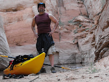
You are certain to double your pleasure at Crooked Creek; it not only has Great scenery but Great kayaking as well. Expect the hours to quickly pass by, especially if you have a camera with you. On this day, I snapped more than a 100 photos of which I included some of my favorites.

I first discovered Crooked Creek earlier in the Spring, but it wasn't as dense as it was today. It made spotting wildlife a little more challenging, but fortunately I marked a few special spots with my GPS (Garmin 76CSx) last time out and was able to find the eagle's nest and a handful of blue heron. Unfortunately, the pictures weren't to my liking, so I guess this gives me an excuse to go back to this gem later in the summer.


Crooked Creek Lake: Additional Pics


Crooked Creek Lake: Additional Pics


Friday, June 19, 2009

Keystone Lake

(June 19, 2009) Today I paddled 5.5 miles

Whatever you do don't confuse Keystone Lake (Armstrong County) and the lake at Keystone State Park (Westmoreland County) because the latter is only a fraction of the size.

Upon leaving the south shore launch near Atwood you have two options. Going left will take you to the larger section of the lake, and right will take you to a more secluded area, which is a prime fishing location. If you continue in this direction you will traverse through a wetlands region, which leads into the North Branch of Plum Creek, but you can only go an additional half-mile before your path is obstructed.

As you turn around and head back to your original destination keep heading SW. This will steer you in the direction of the dam and much more open water, but despite the vastness the waters are pretty calm, especially during the morning hours.


Keystone Lake: Additional Pics


Saturday, June 13, 2009

Loyalhanna Creek: (Launch Inflow Access Area off Rt-22 towards Latrobe)

Link: (June 13, 2009) Today I paddled 7.1 miles

This was my first time paddling this section of the Loyalhanna. The launch site is slightly hidden by vegetation, but still easily accessible from the small parking area. My goal was to paddle all the way into Latrobe, but my journey was cut short due to shallow water about three-quarters of a mile past the bridge on Oasis Road. I don't know if this is common, especially since the water level was pretty high today.

Regardless of the setback I did enjoy the section I covered, which included a handful of mini islands to take temporary refuge from the four sets of small rapids that you will have to vigorously paddle through. While the rapids (Class I, II) are a slight challenge they are navigable, however, don't expect to break any speed records going through them as my average speed according to my GPS was just over 1 mph. Keep an eye out for hidden rocks through these sections and fiberglass boats don't even attempt.

My recommendation: I will probably go back, but only after a heavy rain or perhaps I might try again in the fall when the leaves change colors.


Tuesday, June 9, 2009

Yellow Creek State Park

Link: (June 9, 2009) Today I paddled 5.6 miles

If the early bird catches the worm then the 5:00 AM kayaker gets to paddle on a pristine lake. Without question the best time to visit Yellow Creek is in the morning when the sun burns off the fog and the only sound you hear is a bass jumping from the water in the distance.

Even though Yellow Creek (Indiana County) isn't one of the biggest lakes in the state it still has has plenty to offer would-be paddlers. There are a number of small inlets to relax in as you view the majestic scenery. Visit the dam along your way, but be careful there is a spillway nearby that could take you on an unwanted trip.

Lastly, Yellow Creek is a nice place for novice kayakers, but beware that out in the middle it can get a little rough as the wind likes to swoop in and make paddling a little adventurous.


Yellow Creek State Park: Additional Pics


Saturday, June 6, 2009

Loyalhanna Creek: (Bush Recreation Area to Launch Inflow Access Area off Rt-22)


Link: (June 6, 2009) Today I paddled 13.4 miles

This is one of my favorite flatwater spots in Southwestern Pennsylvania. The scenery is ideal for outdoor enthusiast as you are sure to spot all kinds of wildlife including white-tail deer, numerous species of bird like blue heron, osprey, hawks, and even an occasional bald eagle.

What makes this place nice is that you will rarely come across any motorized boats, so take your time and explore. About a mile into the paddle is a nice rock formation that has tons of layers and years of erosion to occupy your time.

Warning... There aren't many places to stretch your legs, so be sure to take advantage of "Bob's Rock" about 4.0 miles down the creek. It is the only good place that I have found, that allows you to take a break or have lunch.

Finally, A good paddle is to the bridge on Rt-22. Without leaving the main channel for exploration the bridge is about 6 miles from your launch site at Bush Recreation Area.

Loyalhanna Creek: More Scenery


Loyalhanna Creek: Wildlife